| ||
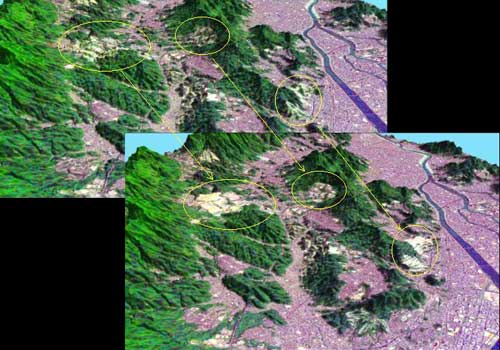
| Land use changes are rapid in urban and surrounding areas by development. Satellite data can be used for correction of existing map or DEM in response to the latest geographic information. The image on the right shows the 3D satellite image by corrected DEM using SPOT stereoscopic images in Hiroshima City. (Processed : HIT, SPOT image : NASDA(C)CNES1998/1999) |
 |
| DEM correction |