| ||
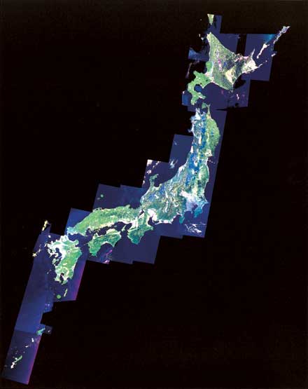
| This mosaicked image below is processed using 47 scenes of LANDSAT/TM data. Color composite image using visible and middle infrared bands represents conditions and patterns of vegetation in Japan. (Processed : HIT) |
|
 |
|
| Satellite image map of Japan | |
| ||
| This mosaicked image below is processed using 47 scenes of LANDSAT/TM data. Color composite image using visible and middle infrared bands represents conditions and patterns of vegetation in Japan. (Processed : HIT) |
|
|
|
| Satellite image map of Japan | |